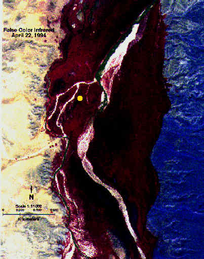
Figure 3. False color infrared image obtained from overflight. Remote sensing here clearly illustrates a sharp transition between the floodplain energy balance and adjacent desert energy balance. The difference between the peripheries are probably due to solar angle and different parent materials. Affixed dot indicates position of the BREB system (Fig. 2). Image provided by Lynn Shaulis, Unversity of Nevada, DRI.